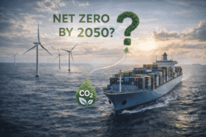

Given the multitude of stakeholders involved in the marine shipping industry and the high stakes at play, every decision has the potential to have significant consequences.
Choosing the best option, whether it be operationally, financially, or environmentally, can be extremely challenging. In order to make timely and effective decisions in a constantly evolving environment, companies in this sector must have complete and accurate real-time information at their disposal.
Satellite data, sensors, and data analysis can provide valuable insights into the marine environment, which can be used to improve marine environmental monitoring, weather forecasting, maritime safety and security enhancement, environmental risk management, and marine policy decision-making.
How can marine stakeholders benefit from the utilization of satellite data, sensors, and data analysis?
Satellite data and sensors offer valuable insights to environmental scientists, water resource managers, and companies seeking to make informed decisions about water management, conservation, and protection.
Monitoring water characteristics is also pivotal for marine contractors to choose the optimal location for offshore installations and assess the potential impact of a project on marine environments.
In addition to private companies, governments, NGOs, and other international organizations rely on satellite remote sensing capabilities to comprehend and forecast changes in the Earth’s environment, specifically in the areas of weather and climate, oceanography, fisheries management, and coastal ecosystems, as well as sustainable development.

What are the main satellite and sensors applications for the maritime industry
Satellite-based applications collectively enhance safety, efficiency, and sustainability within the maritime industry. Here are the main functions used to provide the services and information required by the sector:
- imaging sensors to capture high-resolution images of the Earth’s surface;
- navigation systems like GPS (Global Positioning System) and GNSS (Global Navigation Satellite System) Navigation and Positioning;
- connectivity to enable reliable and efficient communication services, including voice and data transmissions, and internet connectivity.
Similar to satellites, sensors are essential components in the maritime industry for data collection. Installed on buoys, sailing ships, sonar or echo sounders, laser rangefinders or radar, and other underwater vehicles…, equipped with various instruments, they serve various purposes: safer navigation, efficient operations, environmental protection, and improved situational awareness in the maritime industry.
They perfectly replace humans to get remote sensing data, for example from offshore installations, areas that are not easily reachable, or even in deep seas. With the aid of advanced technologies, obtaining more comprehensive information beyond standard measurements is possible. For example, the synthetic-aperture radar (SAR) uses remote sensing reflectances and generates high-resolution two-dimensional images or three-dimensional reconstructions of objects. This spatial resolution overcomes the limitations of resolution in traditional radar systems.
Then, using the principle of the Internet of Things (IoT), the sensors transmit the information gathered in real-time to land-based offices through various communication technologies such as cellular networks, satellite communication services, or radio-frequency communication. These offices use dedicated software to analyze time series at spatial-temporal scales in order to identify patterns, trends, and seasonality, so as to make more accurate forecasts and detect anomalies very quickly.
Predict the ETA of any vessel for free!
Get an accurate prediction of the ETA of any vessel thanks to our ETA Calculator Module. It’s easy, in real-time and free. You just have to sign-up to our HUB.

Marine environmental monitoring
Satellite observations of the oceans provide a global view of the planet as well as a more detailed picture of the coastal and marine environments, including coral reefs, estuaries, and marine sanctuaries. They allow for continuous monitoring of marine ecosystem health, aiding in the conservation and sustainable management of marine resources, tracking of changes, and identification of threats to marine life.
Here is a non-exhaustive list of specific marine environment parameters that can be measured from satellite data and sensors:
- Sea surface temperature can be used to detect changes in ocean circulation and predict phenomena that may endanger marine ecosystems.
- PH levels, dissolved oxygen, and other chemical and physical properties of ocean water over time.
- The presence of harmful algal blooms (HABs), dissolved organic matter (DOM), and other pollutants can be anticipated and managed to minimize their impact on marine life and the fishing industry.
- Sea water levels, which can be used to evaluate ocean movements such as currents, tides, and storm surges.
- Ocean color and coastal zone color, which can be used to determine the concentration of phytoplankton in the water, an essential factors in the food web and ecosystem health.
- The presence of marine pollution, such as oil spills or other events, can be identified to prevent long-term devastating impacts on marine life.
- State of ice, coastal erosion, and other environmental factors that may impact water quality and maritime activities.
In Europe, the European Space Agency (ESA) has chosen to collaborate with Sinay to develop a Digital Maritime Platform. This central hub is a trusted repository that integrates diverse space assets and data sources, leveraging advanced AI technologies to convert them into critical indicators. By providing real-time situational awareness, these maritime modules aim to optimize port operations while addressing challenges related to performance and carbon footprint reduction.
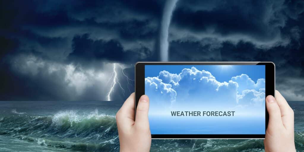
Weather Forecasting
Satellite-based weather monitoring systems provide real-time weather data, such as wind speed, direction, atmospheric pressure, humidity, and temperature, but also storm tracking, wind patterns, and wave heights. This information helps shipping lines and maritime operators plan routes, reduce fuel consumption, ensure the safety of vessels at sea and improve operational efficiency.
Maritime safety and security enhancement
Satellites receive and transmit Automatic Identification System (AIS) signals from vessels, enabling identification and real-time tracking of ships from distant locations. Sensors also help collisions and better manage maritime traffic. Moreover, thanks to GPS and GNSS, they provide accurate positioning, navigation, and timing information for vessels, route planning, and navigation. Communication and location tracking is crucial for crew welfare, emergency communications, and remote vessel management.
In addition, sensors are able to:
- Ease and secure navigation by measuring a ship’s speed, heading, motion, and roll, but also water depth, especially in shallow or unknown waters.
- Detect obstacles and aid in berth management and docking operations.
- Detect the presence of fire or smoke on board ships and if required, trigger alarms and initiate fire suppression systems to prevent and mitigate potential fire hazards.
- Detect unauthorized access, intrusions, or suspicious activities on vessels, in ports, or along the coastline.
- Ensure the integrity and safety of the cargo during transport, particularly for perishable or sensitive items, by tracking parameters such as temperature, humidity, pressure, and weight of goods.
Environmental risk management
Satellite data and analysis can play a crucial role in identifying areas of the ocean that are at high risk of environmental damage or overuse. For example, global ocean observing systems are particularly helpful in monitoring fishing activities, detecting illegal fishing, and identifying areas where fishing is taking place in ecologically sensitive areas. This information can be used to develop appropriate regulations to address these issues and protect natural underwater habitats and marine biodiversity.
Furthermore, collecting data from satellites and analyzing it is crucial for more accurate climate risk assessment, particularly in predicting tropical storms and hurricanes. To do so, scientists and data specialists analyze patterns based on temperature, humidity, and other atmospheric conditions.
Simulations allow them to predict the path, intensity, and duration of these weather events, as well as their impact on communities. This is critical for natural disaster management and emergency response. Officials can make informed decisions about evacuations, sheltering, and other preparedness measures that can help save lives and protect communities. Furthermore, scientists and environmental managers can evaluate the harm caused to coastal ecosystems, such as soil erosion, coral reef bleaching, and wetland disruption, and design restoration plans accordingly.

Marine policy decision-making
Remote sensing technology is efficient in supporting the design of marine policies by providing information on the state of the marine environment, the effectiveness of existing policies and regulations, and the potential impacts of proposed policies. For instance, data on the distribution of marine species and habitats can inform decisions about establishing marine protected areas, while data on shipping traffic and ocean currents can inform decisions about locating offshore wind farms.
Official international bodies like the United Nations’ IPCC (Intergovernmental Panel on Climate Change) contribute to shaping the global response to climate change. Experts and scientists assess the latest climate science and provide policymakers, governments, institutions, and organizations with the most up-to-date and comprehensive information to guide their decisions. Their reports have played a significant role in the development of international climate agreements, such as the Paris Agreement, as well as national and local climate policies and strategies.
What is the future of satellites and sensors roles for the marine sector?
In the United States, the National Oceanic and Atmospheric Administration (NOAA) is in charge of managing and conserving the nation’s coastal and ocean resources. This Washington, D.C.-based uses environmental satellites developed and launched by NASA in Florida.
In Europe, the ESA ensures Earth observation (land and ocean) for environmental monitoring. It has also launched the Climate Change Initiative (CCI), a long-term program that aims to generate and maintain high-quality records for 21 Essential Climate Variables for use in climate modeling, research, and policy development. Satellite and Earth observation data with in situ observations and models enable the release of high-quality environmental datasets that are freely available to the scientific community across the globe.
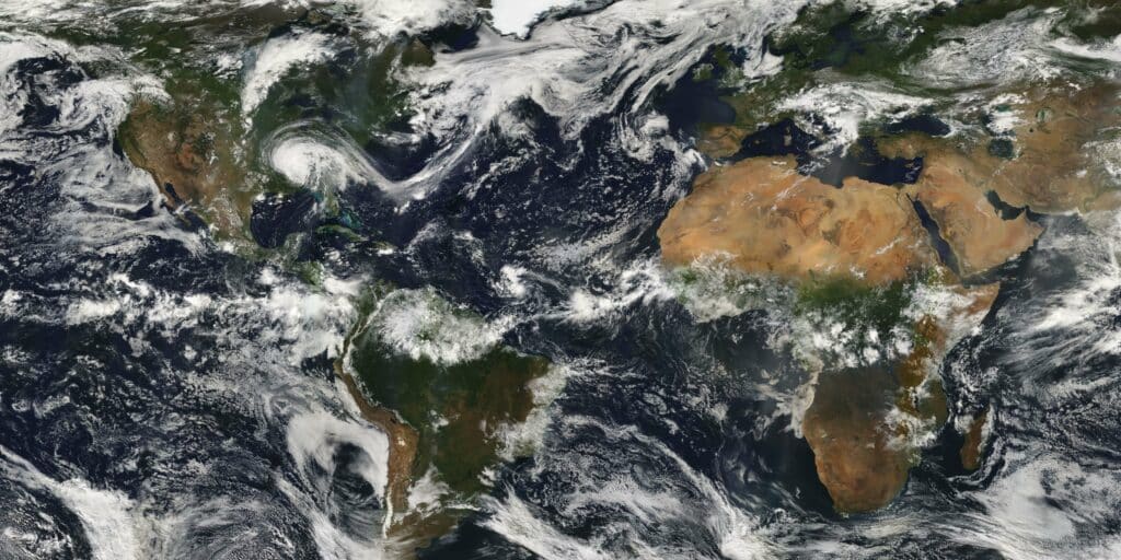
Available through its open data portal, the ESA-CCI data are derived from satellite images gathered by multiple sensors, on missions flown by different space agencies. Institutions from various countries, including the United States and some countries from Asia, partner with European Union member states in this initiative.
Sinay offers marine stakeholders a range of modules that harness the power of Artificial Intelligence and Big Data. These powerful environmental monitoring tools (underwater noise, air quality, or water quality monitoring…) are capable of measuring various indicators using remote sensing, and handling enormous amounts of data. They can also detect patterns that may be difficult to identify using traditional analysis methods. A central user-friendly dashboard eases data consolidation and streamlined processing.
Alongside ongoing field measurements, the maritime industry stakeholders can leverage Sinay’s ready-to-use historical metocean databases and numerical models as a decision-support system that yields high-confidence results. These advanced extensive reports are designed for companies whose activities rely heavily on local weather and oceanographic conditions.
In the coming years, there is an anticipated steady increase in both the quantity and diversity of Earth observation data obtained from satellites. Lately, there has been a growing recognition that satellite-derived variables are fundamental components of a comprehensive and worldwide strategy for monitoring biodiversity.
To guide the process of identifying Essential Climate Variables (ECV) and establish the Essential Biodiversity Variable (EBV) framework for biodiversity variables observable from space, the Group on Earth Observation – Biodiversity Observation Network has played a pivotal role. To ensure routine monitoring of EBVs through satellite remote sensing (SRS-EBV), a consensus should be reached by ecologists and space agencies on the agreed list of variables.
With rapid technological and algorithmic advancements, the scope of satellite remote sensing in biodiversity monitoring is expanding rapidly. In anticipation of the evolution of the list of SRS-EBVs, it is crucial for all stakeholders to establish a clear and unified global platform where data providers, ecologists, and remote sensing experts can collaborate, exchange ideas, and support long-term coordinated actions
Conclusion
The effective and ongoing monitoring of the environment is crucial for gathering knowledge and making informed decisions regarding prevention and mitigation measures.
The utilization of satellite data, sensors, and data analysis can enhance our comprehension of the marine environment, which can lead to more efficient management and conservation of this essential resource. At a broader level, this technology can also help in setting policies and strategies for climate change adaptation in all regions of the globe.
Frequently asked questions about the use of satellite and sensors
Satellite sensors play a vital role in collecting environmental data by capturing high-resolution images of the Earth’s surface and measuring various parameters (such as sea surface temperature, pH levels, presence of pollutants, and other physical and chemical properties of the environment).
This data is invaluable for understanding and assessing changes in the environment, tracking trends, and supporting scientific research and decision-making processes related to environmental management and conservation.
Satellite sensors play a crucial role in weather forecasting by collecting real-time data on atmospheric conditions.
These sensors capture information about parameters such as wind speed, direction, atmospheric pressure, humidity, and temperature, which are essential for predicting weather patterns and phenomena.
Sensors play a critical role in enhancing maritime safety and security by providing valuable information for vessel tracking, navigation, and situational awareness.
Satellite-based Automatic Identification System (AIS) sensors receive and transmit signals from vessels, enabling real-time tracking and identification of ships over vast distances.
Satellite sensors play a critical role in supporting environmental risk management by providing valuable data for assessing and mitigating potential environmental hazards.
These sensors enable the monitoring and detection of various environmental parameters such as water quality, pollution levels, changes in coastal ecosystems, and fishing activities.
By collecting data on these variables, satellite sensors help identify areas at high risk of environmental damage or overuse, detect illegal fishing activities, and aid in the development of appropriate regulations and conservation measures.