
Safety and efficiency are key for all players in an increasingly competitive and rapidly evolving sea transportation industry. In this regard, some ships’ categories must be equipped with an AIS. This automated, autonomous system aims at locating any vessel anywhere it may be, and at allowing it to exchange navigational information with various third parties. This article gives an insight into the AIS: how it works, what technology is used, what kind of data is shared, who uses it, and what are its limitations.
What is AIS and whats is used for?
“AIS” stands for “automatic identification system”. It forms part of the Global Maritime Distress and Safety System (GMDSS). Anywhere in the world, AIS is used to electronically broadcast a ship’s position to all other nearby AIS-equipped ships or ashore (terrestrial-based) and even satellite-based stations, using DSC (Digital Selective Call, a feature that enables calls between VHF radios). Even when visibility is low, each vessel’s crew knows who’s around them, where exactly they are, what kind of vessel they use, at what speed they sail, what is their heading, etc. These warnings of proximity enable fast course corrections whenever needed.
Since December 2004, The International Maritime Organization (IMO) and other management bodies in the maritime world have made AIS mandatory on all large vessels for easy identification, tracking, and monitoring, but also as an aid to navigation, working as a real-time radar for collision avoidance. Hence it offers additional safety in dangerous conditions. And with the boat’s name and MMSI number, direct call from other vessels or ashore authorities is possible through the VHF radio.
Thanks to an AIS API, any company can quickly and smoothly integrate AIS-related data into its existing software. This interface fastens the integration of the new tool into existing information systems while avoiding potential compatibility issues and reducing costs. As an expert in artificial intelligence-based solutions for the maritime industry, Sinay has developed an API that allows users to retrieve all AIS information of a specific vessel by only entering its MMSI or IMO number. This helps customers enhance situational awareness and follow-up of their ships’ performance. Integration of accurate and real-time data into their daily tools is quick and easy, thanks to detailed documentation and support of reactive customer service.
How does AIS work?
AIS is a modern, yet simple system that only needs power, an antenna (or an antenna splitter then use the same antenna as the VHF radio), and a connection to the main system. It uses the vessels’ GPS or other internal sensors to track the ship’s position. The collected information is then collated with a pre-configured value in the system. Both are transmitted in the background at regular intervals whilst also receiving other vessels’ AIS information.
All information received from AIS transponders, will either:
- be displayed on each ship’s navigational equipment (chart plotter and radar screens). Each vessel is represented by an icon which is to be clicked to get all the vessel data.
- or made available to all either by direct reception or on various specialized websites and applications, thanks to transmissions to the Internet. They gather data from multiple receiving points and aggregate them to give an overall picture.
Recently, AIS has been integrated into Man Overboard devices such as personal locator beacons for members of a vessel’s crew or lifejackets. These new devices appear on chart plotters of nearby vessels. They hence have a major advantage over the conventional satellite-based units (EPIRBS) that only alert shore-based search and rescue authorities.
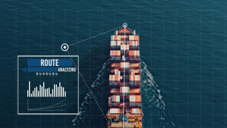
How to Track a Ship In Real-Time ?
Let us look at how a ships’ real-time tracker works, its details and features, its benefits for all players in the shipping sector but also its weaknesses…
What is the range of AIS?
AIS-receiving station fitted with an external antenna placed 15 meters above sea level can get information from all AIS-equipped ships that sail within a 15-20 nautical miles (NM) radius of its location. This range corresponds to a Class-A transponder output.
The reception efficiency of a base station mainly depends on its antenna height: the more it is, the better AIS data from other ships are received or sent to the maximum range. This means that stations located at a higher altitude benefit from an extended range of up to 40-60 NM.
Apart from elevation, three factors have an impact on the signal strength:
- the antenna type;
- the potential barriers or disturbances in the area;
- the weather conditions;
- the humidity in the area: high humidity leads to poor coverage. However, humidity levels have a lower impact on Class A transponders compared to Class B receivers, which are not as powerful.
Horizontally, the AIS signals have a range of roughly 40 nautical miles. This is the reason why the AIS traffic information is only available in the near-shore zones and ship-to-ship areas.
What are the types of data shared via AIS?
AIS allows electronically data transmission of static and dynamic vessel information:
- Vessel name and Maritime Mobile Service Identity number (MMSI), which is its unique identification number
- Type of vessel: cargo, passenger, fishing;
- Vessel’s current coordinates: latitude (LAT) and longitude (LON);
- Vessel course over ground (COG) and speed over ground (SOG);
- Vessels’ dimensions (length, width, and draft)
- Vessels’ navigational status (“underway”, “at anchor”, “alongside” etc.), which is manually set by the crew;
- Heading (0 to 359 degrees);
- Rate of Turn-right or left (0 to 720 degrees per minute);
- Bearing at own position (0 to 359 degrees);
- Port Call Arrivals and/or Departures;
- Distance to the closest point of approach (CPA);
- Time to the closest point of approach (TCPA);
- Time stamps (UTC), which is the UTC (in seconds) when the subject data packet was generated.
However, the type of data transmitted may vary from Class-A and Class-B AIS transponders.
The above-mentioned data are automatically transmitted at a fixed frequency, depending on the vessel’s status:
- while underway: every 2 to 10 seconds depending on the vessel’s speed and course, or if it is at anchor;
- when anchored: every 6 minutes.
Who benefits from the use of AIS?
Various stakeholders get substantial benefits from the use of AIS:
- Ship owners greatly rely on this technology to provide information on top of data taken from traditional radars. It helps them to track each unit of their fleet, monitor its performance, and maximize the safety of their people and vessels.
- Maritime authorities’ shore-based stations improve monitoring of the traffic within surroundings waters, better manage flows and operations to lower port congestion, and if needed, contact ships directly and warn them of potential hazards.
- Search and rescue units such as coast guards can immediately head up in the right direction to provide swift assistance to ships or people in distress.
- Any user, individual or business, can track a cargo ship’s location and progress at sea, via AIS maritime tracking services. All data needed to do so is the name or unique IMO number of the vessel carrying the cargo.
What are the types of AIS used by ships?
There are typically three types of AIS equipment: Class-A, Class-B, and receiver only. Several differences have been identified:
Class-A
According to IMO rules, all passenger, and commercial vessels above 300 Gross Tonnage (GT) that travel internationally must be fitted with a Class A AIS transponder. Indeed, this type of equipment broadcasts more information every 2 to 12 seconds and at higher power. It operates on 12 watts and transmits data with a range of 20 miles (which can increase if the right antenna is placed high enough).
Most of the information is obtained from onboard instruments such as the GPS, whilst some require manual input: number of passengers, vessel status, and next port of call.
Class-B
Class B AIS transceivers are intended for smaller vessels (e.g. leisure and recreational boats, small fishing vessels) where the fit is not mandatory. Most models are “fit and forget” and do not need manual entries. The ship’s details input is done at the time of the installation, and then the transponder automatically shares vessel name, callsign (MMSI), position, COG, and SOG.
Class B transceivers have fewer interfaces and have lower transmitting power than Class A ones. They operate at 2 watts and the data transmission frequency is lower (approx. 30 seconds) at a range of 5 to 6 miles (receiving range may vary). Furthermore, Class B for voluntary fit vessels is designed to give priority to transmission from Class A transceivers, especially in congested areas. This means that all Class A transceivers transmit their data before Class B are allowed to reserve a time slot for their transmission. Class B systems’ main advantage over Class A transceivers is that they are cheaper.
For Class A and B units, the first entry of the vessel details at the time of a new installation requires a PC using a program called Pro AIS. Depending on the country, the entry may be done by the boat owner (in the UK for example) or may require an authorized installer (in the United States)
Receivers only
Some small vessels use AIS receivers to receive transmissions from AIS-equipped vessels without being seen themselves.
Is the AIS mandatory on all ships?
An AIS transponder is mandatory on commercial vessels with the following characteristics:
- ships of 300 gross tons and upwards engaged on international voyages;
- cargo ships of 500 gross tonnages and over not used for international voyages;
- passenger ships of any size.
On another side, AIS is not required for small commercial vessels or cruising yachts. However, it is recommended to carry one for security purposes. The ship owners who choose to do so shall go for a Class B transponder or a receiver only.
When can AIS be switched off?
According to IMO guidelines, AIS should always be in operation whenever the ship is underway or anchored. This provision, which is to be found in the IMO Convention for the Safety Of Life At Sea (SOLAS) Resolution A. 917 (22), has been taken for better visibility and safety reasons.
The only exception to this rule is when:
- the ship is in imminent danger;
- the ship’s captain is certain that maintaining the signal broadcast will compromise its safety and security. In such case, he/she must record the incident in the unit’s logbook and fill a report to the competent authority, including a valid reason why he/she has decided to switch the AIS off, as well as the other measures taken.
The “silent mode” is primarily used while sailing into dangerous waters (suspected presence of armed pirates) and it should be temporary. The AIS should be switched back on as soon as the threat is not considered imminent anymore. Otherwise, the vessel might be considered a “dark vessel” that participates in illegal activities.
Unfortunately, AIS is sometimes disconnected to hide unethical and negative behavior such as illegal, unreported, and unregulated (IUU) fishing. An example is the use of commercial fishing vessels that are not properly registered and do not have the necessary documentation to prove that they are operating legally in a country. It can also include the fishing of endangered species, in protected areas, not respecting quotas, etc.
To counter this phenomenon, methods are being deployed to track the magnetic signature of these vessels. More and more innovations will be developed to mitigate this illegal and destructive fishing of our underwater biodiversity.
How to Track a Ship In Real-Time ?
Let us look at how a ships’ real-time tracker works, its details and features, its benefits for all players in the shipping sector but also its weaknesses…
Conclusion about AIS
AIS is indeed a major development for improving safety at sea and traffic monitoring while helping to make better decisions. However, the system still has some deficiencies. Put into operation in 2002, AIS was developed in 1996. Back then, most of the new technologies currently used in the marine shipping industry were non-existent or barely emerging. The best examples are data security, SDR (Software Defined Radio), Internet of Things (IoT), or large-scale satellite constellation deployments). As a result, the main limitations of AIS are its limited capabilities in terms of cybersecurity (lack of data encryption) and satellite reception (limitations of the protocol for SAT-AIS).
On top of that, coverage gaps might appear because of the internet connexion quality in some areas. However, continuous improvement is observed. Recently, several providers such as Orbcomm have made AIS information transmission possible by satellite. Fleet managers must subscribe to access the service, but this technology offers new opportunities to all maritime industry stakeholders.
Frequently Asked Questions About AIS
“AIS” stands for “automatic identification system”. It forms part of the Global Maritime Distress and Safety System (GMDSS).
Thanks to AIS, we can know the vessel’s identity and characteristics, the type, the position, the speed: all the information related to the identification and the safety of a ship. AIS allows tracking a vessel.
Thanks to AIS, the safety and traffic monitoring at sea are improved. It also allows to a ship’s position to all other nearby AIS-equipped ships or ashore and even satellite-based stations. All of this improves safety at sea.
AIS transponder is mandatory only on commercial vessels that have some characteristics: a ship of 300 gross tons, cargo ships of 500 gross tonnages, or passenger ships.
Even if the AIS is not mandatory for all ships, it is recommended to carry one for security and safety.