Below the glistening waves, a hidden world thrives, powering life and climate across the globe. At the heart of this system are ocean currents, the hidden highways of our planet. They shape weather patterns, influence marine life, and play a crucial role in global climate systems. For centuries, sailors and scientists have sought to understand these powerful flows to improve navigation and predict environmental changes. Today, advanced technologies allow us to measure and forecast currents with remarkable precision, supporting maritime planning and conservation efforts. This article explains ocean currents, their causes, and how we study them, highlighting their importance for life on Earth.
Understanding Ocean Currents and Their Importance
Early sailors noticed that some parts of the sea carried their ships faster, hinting at invisible forces beneath the surface. In the 16th century, explorers like the Portuguese navigator Ferdinand Magellan began documenting these steady flows. Today, we know ocean currents are vast, continuous movements of water that distribute heat, nutrients, and energy across the globe.
What Are Ocean Currents?
Types and Characteristics of Ocean Currents
Surface Currents
– Driven by wind and Earth’s rotation
– Form large loops called gyres (e.g., North Atlantic Gyre)
– Transport warm water across oceans and regulate climate
Deep Ocean Currents
– Driven by temperature and salinity differences
– Create dense water masses that sink and flow globally
– Part of the global conveyor belt, a thousand-year circulation system
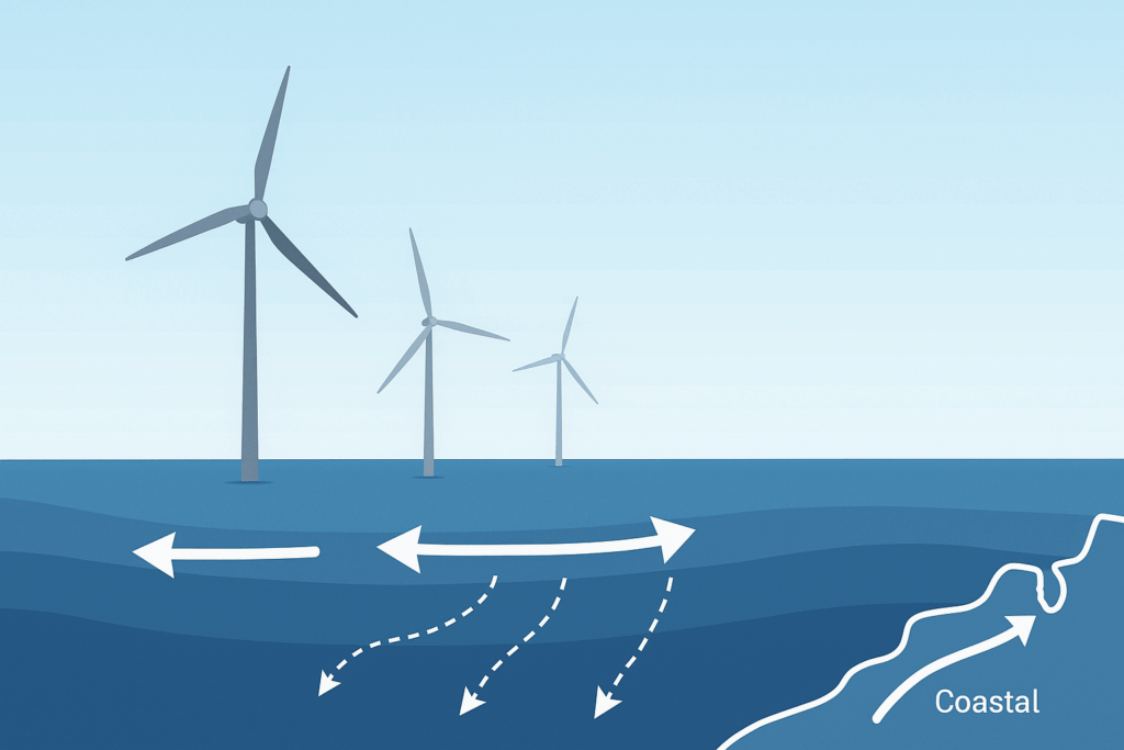
Coastal Currents
– Influenced by tides, winds, and coastal shape
– Move sediments and nutrients over shorter distances
– Crucial for coastal ecosystem health
Subtropical Gyres
– Move heat toward the poles
– Accumulate floating debris, affecting marine biodiversity and pollution
Why They Are Important
Long-term observation of these patterns allows scientists to develop models and generate forecasts that enhance the accuracy of weather and ocean condition predictions. Accurate measurements enable navigators to plan safer shipping routes and support resource planning for industries like fisheries and offshore energy. In the long term, reliable prediction of a current’s behavior helps protect sensitive marine ecosystems by anticipating nutrient flows and migration patterns.
Careful observing and modeling also ensure that maritime activities remain efficient, sustainable, and responsive to changes in ocean dynamics. Without these flows, regional climates would become far more extreme, making much of Earth less habitable for both humans and marine life.
Influences and Impacts
In the Pacific Ocean, the Kuroshio Current, or Japan Current, is a warm flow moving northeast past Japan and shaping the region’s climate. It is part of the North Pacific Gyre and spreads heat, nutrients, and marine life across the western Pacific. The Gulf Stream, a warm current from the Gulf of Mexico, flows along the U.S. East Coast and toward Europe, bringing warmth that moderates western Europe’s climate. The Antarctic Circumpolar Current is a cold, powerful flow circling Antarctica eastward, linking the Atlantic, Pacific, and Indian Oceans. As the world’s strongest current, it moves vast water volumes and helps regulate the global climate. How do ocean currents influence climate and impact marine ecosystems?
Critical Elements That Shape Ocean Currents
Wind patterns push surface water, driving a current in the direction of prevailing winds over the sea.
The Earth’s rotation causes the Coriolis effect, which deflects moving water to the right in the Northern Hemisphere and to the left in the Southern Hemisphere, shaping flow paths.
Salinity and temperature gradients change water density, causing heavier water to sink and lighter water to rise, fueling deeper circulation within the system.
Topography, including underwater ridges and continental shelves, redirects flows and creates local variations.
Tides, driven by the moon’s gravity, influence coastal flows with regular, predictable changes in sea level and movement.
Impact on Climate and Weather Patterns
Oceanography and atmospheric science rely on satellite data and real-time measurements to understand how currents can influence global and regional weather systems. The Gulf Stream, for example, helps keep parts of Europe mild, while disruptions in Pacific flow patterns contribute to extreme events like El Niño and La Niña. These phenomena can shift rainfall, intensify droughts, and alter monsoon behavior. National agencies use high-resolution models and forecasting tools to track these effects and issue timely warnings. Operational forecasting supported by ocean-atmosphere interaction research helps predict what will happen weeks or months ahead. Through continued investments in satellite networks and advanced modeling, scientists aim to improve real forecasting systems and protect communities worldwide from the growing unpredictability of weather.
Effects on Marine Ecosystems and Biodiversity
Measuring and Predicting Ocean Currents: Tools and Techniques
Two forms of ocean movement, upwelling and downwelling, have a major impact on where sea life thrives and how abundant it becomes. Upwelling consists of deep water rising to the surface, sweeping vital nutrients into sunlit zones where sea life thrives. While most organic matter settles far below, this process returns it to areas of high productivity, fueling rich ecosystems. Downwelling is the sinking of surface water, essential for life on the sea floor. It occurs when converging flows or winds push water downward along coastlines. What are modern tools, methods, and innovations in ocean current research, and how do they support maritime planning?
Traditional and Modern Techniques
Drifters
Floats
Current meters
Moorings
Satellite altimetry
ADCPs (Acoustic Doppler Current Profilers)
Technological Advancements in Measurement and Forecasting
Real-time monitoring
Remote sensing
Modeling systems
AI prediction
Global ocean observing systems
Sinay’s Tools for Reliable Ocean Flow Analysis
Mastering Ocean Flow for Sustainable Seas!
Ocean currents are the chemical balance throughout the ocean layers and play a vital role in supporting ocean life. Understanding ocean flow is essential for protecting these systems and ensuring a sustainable future. We must deepen our knowledge and invest in monitoring technologies to safeguard the health of our oceans for generations to come.
FAQ about environmental monitoring for offshore projects
They help ensure regulatory compliance, minimize environmental impact, and optimize operations by tracking key factors like water quality, emissions, and noise levels.
Advanced sensors, IoT devices, AI, and real-time data analysis are used to collect and process environmental data for better decision-making.
They detect pollution, habitat disturbances, and climate-related threats early, allowing proactive measures to prevent damage.
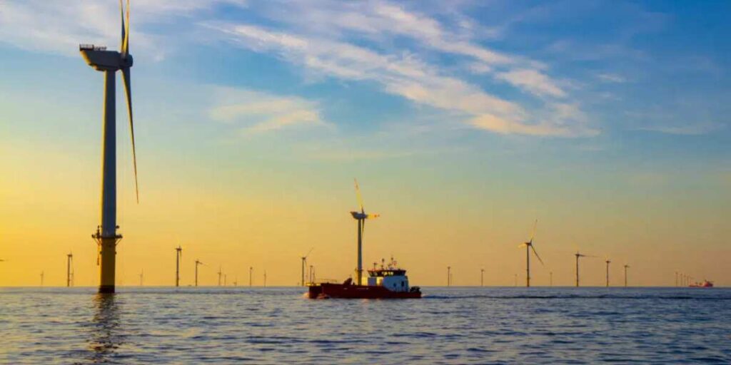
Sectors like oil & gas, wind energy, and aquaculture use these systems to maintain sustainability and improve efficiency.