Metocean concerns understanding meteorological and oceanographic conditions in offshore coastal engineering or renewable energy projects.
Metocean is an acronym combining the words meteorological and oceanographic.
Detailed quantitative insight into metocean conditions is essential for the success of marine projects, for example, the offshore renewable energy market (OR). Understanding the meteorological and oceanographic conditions removes ambiguity in engineering specifications and improves operational efficiencies as well as safety.
Crucial points of the article to remember about metocean:
- Metocean conditions, crucial for marine projects, blend meteorological and oceanographic data.
- Accurate understanding enhances safety, efficiency, and resource optimization.
- Studies inform every project phase, from site selection to decommissioning.
What are the key metocean conditions?
Conditions
Metocean conditions are a combination of wind, wave, and ocean currents in a specific area.
There are several principal parameters when considering the application of metocean data.
Meteorological conditions include factors such as wind (speed and direction), air temperature, surface atmospheric pressure, relative humidity, surface wind vectors, precipitation, visibility, and the incidences of typhoons, hurricanes, and cyclones.
Oceanographic conditions comprise of changes to water levels (e.g., water heights due to storm surges, and tides), water temperature, salinity, underwater depth of floors, the stratification in water, and the occurrence of ice.
More precisely, the metocean condition is observed in the following meteorological and oceanographic situations:
- Local surface winds (e.g., sea or land breezes)
- Wind-generated local waves
- Swell (i.e., long-period waves caused by distant storms)
- Surface current created as a result of local storms
- Vigorous deep-water currents due to low frequency, large basin circulation, and non-storm-related and site-specific currents. Examples are the loop current in the Gulf of Mexico or the coastal current in the Norwegian northern North Sea.
Origins of metocean
The term ‘metocean’ first originated in the oil and gas industry in the 1970s, however, following the growth of the offshore renewables sector, interest in the understanding of metocean conditions is increasing, particularly due to digitization.
An understanding of these conditions necessitates access to data and analytics.
The Metocean Analytics Module, created by a team of oceanographers specializing in high-resolution modeling, statistical analysis, and data mining allows you to optimize your efficiency and productivity. We provide support for offshore and coastal engineering projects by supplying Metocean Analytics using data sources from public and private databases.
What are the benefits of undertaking metocean condition studies?
In planning a project, metocean information is necessary throughout the project lifecycle; from site selection and feasibility to development, design and certificate, ion, installation, operations, and management, before finally reaching the decommissioning phase.
There are several benefits to embarking upon metocean condition studies. Data obtained during a project ensures that all circumstances relating to the local weather, sea, and other factors are considered during the planning and construction.
Key benefits include:
- Accurately evaluating the marine environment. This allows risks to be quantified and measured during the exploration project.
- Effectively and efficiently planning and designing offshore structures during the course of a project.
- Maximizing the efficiency of resources, for example, due to delays caused by extreme weather.
- Supporting the effective use of offshore resources, transportation, and marine vessels.
Metocean studies are relevant to a range of offshore, coastal and marine engineering projects. This includes offshore wind and other renewable energy projects, deep-water drilling, and oil and gas exploration, whether these are fixed or floating wind, wave, or tidal structures.
Offshore constructions involved in undersea exploration work in the oceans often face challenging environmental conditions because of extreme winds, strong waves, and currents. Marine vessels experience similar challenges, and therefore both require access to meaningful metocean data.
For offshore and marine projects, metocean conditions are normally categorized as operating or extreme:
- Operating: quantifying the metocean conditions to ensure that an offshore project or marine vessel can deliver to its full capabilities.
- Extreme: for example, storms, hurricanes, and cyclones.
Using metocean data can give a better comprehension of the local climate. For example, it can assist in determining the probability of extreme events and weather windows.
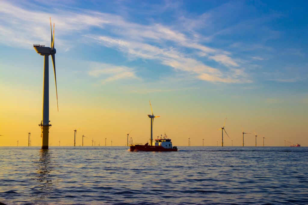
Assessing metocean conditions for the development of offshore wind projects
Globally, the offshore wind energy market is growing significantly. Currently, the industry market size is valued at USD 27.33 billion (2021) – with forecasts, this will increase to USD 129 billion by the end of the decade.
Offshore wind farm developers and companies operating this important form of renewable energy require access to accurate quantitative data to assess metocean conditions. The data will determine the project’s design and implementation and provide information about productivity.
Metocean conditions vary across the globe with distinct regional environments. The early days of the offshore wind industry saw projects focused on northern Europe, particularly the North and Baltic Seas. Now, environmental developments are spread across the globe as companies seek detailed research into localized wind systems, assessing the potential for new offshore wind farms. Projects are now underway along the US Eastern Seaboard and Taiwan.
As these developments expand globally, collaboration between industry stakeholders and environmental agencies becomes increasingly important. Sharing data and insights can foster innovation and ensure sustainable growth in the offshore wind sector.
Moreover, advancements in technology, such as remote sensing and AI-driven analytics, offer promising opportunities for enhancing the accuracy and accessibility of metocean data, ultimately supporting the efficient and responsible development of offshore wind projects worldwide.
How are metocean studies undertaken?
Metocean studies necessitate the analysis of significant amounts of data. Projects require data validation plus a determination of what constitutes normal and extreme metocean conditions, as well as offshore to the nearshore transformation of data.
Sinay has developed an online solution for each phase of an offshore project, enabling the delivery of a preliminary metocean analysis of real-time data and reports in just a few minutes. This solution uses the Metocean Analytics tool, enabling the estimation of offshore operations weather downtime to optimize operational planning in projects.
Conclusion
As the world seeks to minimize environmental impacts, promote the use of renewable energy and protect our oceans, developing our understanding of metocean conditions has never been more important.
Accessing accurate, reliable, and real-time data is critical. The application of online tools can provide valuable analysis to support offshore and coastal engineering projects globally, from the initial feasibility and planning stages through to offshore implementation.
Frequently Asked Questions About Metocean
Because Metocean Analytics contributes to increasing efficiency across all stages of any offshore project! During the feasibility study, the planning, the design, the construction or installation, operation, maintenance, and removal.
Focus on data to make effective decisions
Discover our modules
Environmental Monitoring
Monitor air quality in real-time, be alerted when a threshold is reached & easily comply with regulation thanks to the automated reports.
Monitor water quality in real-time, predict and avoid water pollution & comply with regulations thanks to the automated reports.
Deliver a preliminary metocean analysis and the associated report in jut a few minutes.
You may also be interested by those others environment application :