Whether it is for curiosity, to follow a cargo, or for the management of a fleet, anyone interested in the location of a vessel is looking for updated data. To accomplish this task, AIS technology has been developed and implemented onboard. If these systems are a precious help for the safety of navigation, the regulations for their use do not apply equally to all. In this article, we will focus on some categories of vessels, how we can track them at sea or in port, and the development of new tools to improve the information received.
The different types of vessels sailing around the world
Can all ships be tracked?
Vessel tracking is a critical aspect of maritime safety, security, and environmental protection, enabling the monitoring of vessel movement and the identification of potential risks.
While the use of technology, such as the Automatic Identification System (AIS), has made it easier to track vessels at sea, not all ships can be tracked using these systems. The AIS is required for certain types of vessels, including commercial ships over 300 gross tons and all passenger ships.
However, fishing boats, smaller and military vessels may not be required to have AIS equipment installed, and therefore cannot be tracked through this system. Additionally, some may choose to turn off their AIS equipment to avoid detection, such as vessels engaged in illegal activities like piracy or smuggling.
As a result, there are limitations to the ship types that can be tracked at sea, and it’s important for maritime authorities to consider these limitations when implementing vessel monitoring and surveillance systems. By understanding which ships can and cannot be tracked at sea, maritime authorities can make informed decisions and develop appropriate strategies to ensure the safety, security, and protection of the marine environment.
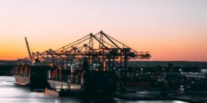
How to Track a Ship In Real-Time ?
Let us look at how a ships’ real-time tracker works, its details and features, its benefits for all players in the shipping sector but also its weaknesses…
Ships that can be tracked
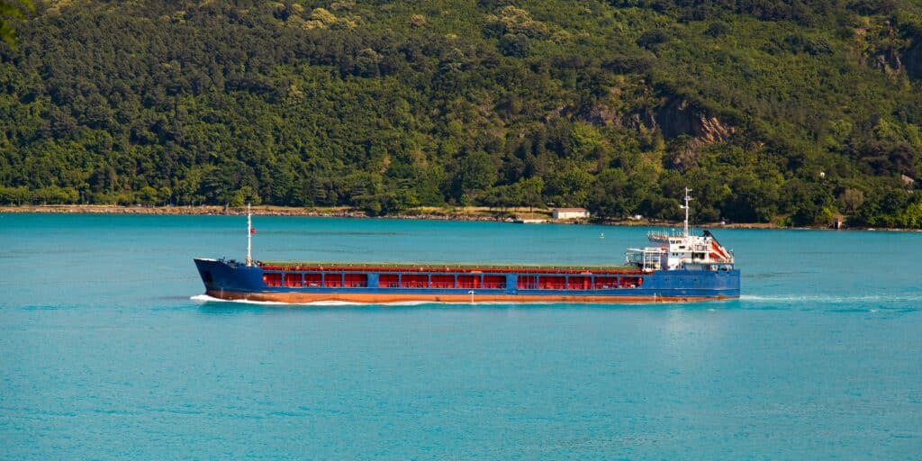
Oceans are crossed every day by a variety of ships. The criterion used to classify them is the type of cargo they carry. In commercial shipping, the main categories are the following:
- Tankers: Built for the transportation of liquids like oil, gas, chemicals, or juices and wines.
- Bulk carriers: Designed with several holds closed by hatch covers to protect grain, ore, coal, or other unpacked dry cargoes.
- Container ships: Standardized containers usually 20 or 40 feet are loaded in their holds and on deck and are mainly used for transporting manufactured goods.
- Ro-Ro vessels: Roll-on/Roll-off transport vehicles like cars or trucks. They are fitted with ramps for the loading and unloading operations.
- Reefer vessels: They stow sensitive goods such as fruits in temperature-controlled holds. They are disappearing to make way for the use of reefer containers on board container vessels.
- General cargo vessels: They are loaded with various packed cargoes and are fitted with their own cranes for port operations.
- Passenger ships: Ferries or cruise vessels that carry passengers for leisure purposes.
- Specialized support vessels: Their mission is to assist or to do special works like towing operations at sea.
- Fishing vessels: They carry out fishing activities using different types of techniques such as trawling.
Commercial ships are not the only ones to navigate on international water. Civilian and military vessels are also on all maritime routes. Recognizing all of these different ships is useful knowledge to track them efficiently.
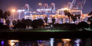
How are commercial ships tracked?
If nowadays it is possible to know in real-time the position, speed, and course of a vessel anywhere in the world, it is thanks to Automatic Identification Systems (AIS) technology.
The International Maritime Organization (IMO) adopted a requirement in 2000 to make these systems mandatory onboard certain types of ships. The ones fitted with AIS transmit information to equipped shore-based stations, satellites, and ships nearby.
It is a very high-frequency (VHF) radio communication system that operates on two dedicated frequencies: 161.975 and 162.025 MHz.
It is composed of 27 types of messages classified into four categories of data:
- static (e.g., ship name),
- dynamic (e.g., speed),
- voyage (e.g., next port of call),
- and safety text messages.
If dynamic information is provided by the in-built Global Positioning System (GPS), the voyage and static information are entered manually by the ship’s crew.
Meanwhile, AIS is not only a remote tracking device but also a tool for ship-to-ship collision avoidance at sea. It is indeed an aid for the Officer on Watch (OOW) to make good decisions and ensure the safety of navigation. The data provided by these devices are also collected for container tracking or by port authorities, Vessel Traffic Services (VTS), or Panama Canal, to manage the traffic in their area.
For security reasons, AIS should therefore always be in operation. However, the Master may decide to switch it off if he considers that using AIS endangers the vessel. It will be the case if she transits in waters with a high risk of piracy.
Can we track cargo ships?
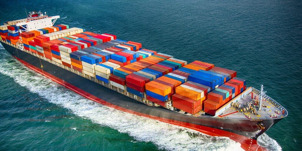
The installation of an Automatic Identification System onboard cargo ships for tracking is not mandatory for all of them. According to SOLAS regulation V/19, transponders must be fitted:
- On all ships engaged on international voyages with a gross tonnage of 300 or more.
- And on cargo ships not engaged in international voyages but with a gross tonnage of 500 or more.
These requirements covered the majority of cargo ships in service. Indeed, the gross tonnage has been steadily increasing the recent years. MSC Irina, which is at the moment the world’s largest container ship, has a gross tonnage of 236,184 tons. Although the use of AIS has become widespread, this technology has some limitations.
The first one is its level of accuracy. The crew may have forgotten to update the voyage data or dynamic information can be incorrect due to GPS error.
The second one is its range. In horizontal the signals do not exceed 40 nautical miles. Tracking a ship in real-time is thus limited to land-based stations or ship-to-ship areas. That’s why the MarineTraffic website, one of the most used tracking apps, combined information from their terrestrial network and from satellites to improve the quality of data.
With Satellite-AIS (S-AIS), the status does not appear as “Out of range” and the position will be checked remotely even if they are sailing on the high seas. To access it, it is only necessary to know the vessel’s name or her IMO number. It consists of seven digits and it is assigned at the construction of a ship for her entire life.
Can we locate cruise ships?
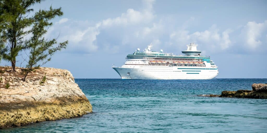
Safety requirements are always stricter for passenger vessels. The use of AIS to locate these floating hotels does not depend on any size or voyage basis: it is mandatory equipment onboard. AIS data can be used by various bodies and for multiple purposes. This is notably the case in monitoring the environmental impact of the vessels by authorities.
The cruise industry through the Cruise Lines International Association (CLIA) is currently working on reducing its carbon footprint. This association is composed of the major cruise lines: Carnival Corporation, Royal Caribbean Group, Princess Cruises, Norwegian Cruise Line, and more than fifty members. Their objective is to propose zero-emission cruises by 2050, in particular, with the use of liquified natural gas (LNG).
AIS records combined with the ship’s technical specifications are an aid for the actors of the maritime industry to estimate emissions. The global cruise market is indeed growing and always bigger new ocean liners are being built every year. The information transmitted by the AIS system is helpful for measuring their environmental impact at sea or in ports, but it is also used for tourist purposes. Passengers can visit an online tracking website to find out about a cruise itinerary.
To track the vessels, an app like CruiseMapper offers the possibility to select a specific port or line and have an overview of the whole fleet of a company on a map. From home or office, you can follow cruises whether in Alaska, the Caribbean Sea, or Norwegian fjords. The dynamic information (course, speed, heading) is provided for free if the vessel is near a shore station. If she is in the middle of the seas, a subscription to a satellite service is necessary to receive the accurate position.
Can we track military/naval ships or submarines?
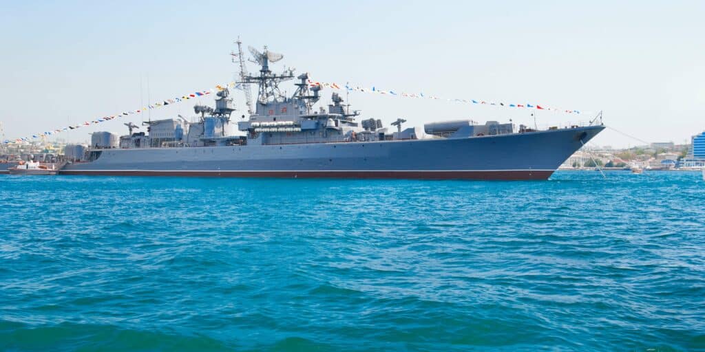
Unlike ships doing commercial shipping or cruises, the ones belonging to states and navies deal with sensitive situations where it is necessary to hide their position. Even if warships are exempted from SOLAS Chapter V related to the safety of navigation, they are encouraged to follow these good practices.
Enhanced transponders adapted to military requirements are fitted onboard. Warship AIS or W-AIS systems have additional functionalities which are not included in a classic AIS. One of them is the possibility of sending encrypted messages. This allows the exchange of private information between armed forces.
A second one is AIS spoofing: users can create a false ship identity and location and broadcast these erroneous data through AIS radio frequencies. The vessel can thus sail discreetly on the waters of a hostile nation.
Naval ships or submarines may also decide to turn off their AIS to remain anonymous. If they live it on, it is possible to locate them on an app like any other vessel equipped with this technology. The only difference is that you have to use their name and not the IMO number. This identification process is mandatory for merchant ships but does not apply to naval vessels. Instead, a hull or pennant number is assigned to them, according to the navy to which they are attached.
Tracking vessels with a powerful API
The development of Application Programming Interfaces (APIs) revolutionized the shipping industry. It gives access to live information on the location and status of vessels by means of Automatic Identification Systems.
Instead of tracing their travel one by one, API will build a custom ship database thanks to IMO or Maritime Mobile Service Identity (MMSI) number.
The MMSI is composed of nine digits and is used to identify a vessel. It is programmed into AIS and is part of the dynamic information automatically transmitted by the transponder. In addition to being a time saver, APIs are efficient management tools for logistic parties. Through the collection and analysis of data, they announce the next port of call and the estimated time of arrival (ETA). Delays and disruptions are anticipated and as a result, the management of the supply chain is improved.
APIs have a wide range of applications like the tracing of shipments. Sinay launched a container tracking API to locate goods in real time anywhere in the world. Indeed not only ships are fitted with positioning devices. Smart containers have trackers which record and relay each step of their travel. These equipment are part of what is called the Internet of Things (IoT) connected trackers. API developed by Sinay provides the events related to port operations, the latitude and longitude, and the ETA of containers.
Rather than checking manually the position of the ship on which they have been loaded, you receive reliable information and relevant notifications by entering the Bill of Lading, the container number, or the booking number.
How to Track a Ship In Real-Time ?
Let us look at how a ships’ real-time tracker works, its details and features, its benefits for all players in the shipping sector but also its weaknesses…
Conclusion
Locating ships has become easier with the implementation of AIS technology onboard vessels. Their data are now exploited by APIs for more accuracy. It improves the tracking of ships and takes part in the growth of the maritime industry.
Frequently Asked Questions About Ships Tracking
Most commercial vessels, including cargo ships, tankers, and cruise ships, are equipped with Automatic Identification System (AIS) technology that allows them to be tracked.
However, smaller vessels, fishing boats, and pleasure craft may not be required to have AIS and may not be trackable.
Ship tracking relies on a combination of technologies, including AIS, radar, and satellite tracking. AIS is the most commonly used method, as it transmits a ship’s identity, position, course, and speed to other vessels and shore-based monitoring stations.
This information can be accessed by anyone with an AIS receiver or through online tracking services.
Ship tracking provides valuable information for maritime safety and security, as well as for commercial purposes such as fleet management and logistics.
It can help prevent collisions and aid in search and rescue operations, and can also improve efficiency and reduce costs for shipping companies.
While ship tracking can provide a wealth of information, there are some limitations to the technology. Ships may turn off their AIS transmitters to avoid detection, and smaller vessels may not have AIS at all.
Additionally, tracking data can be subject to errors or delays due to factors such as weather conditions or equipment malfunctions.
Ship tracking technology is constantly evolving, with new innovations such as satellite-based tracking and artificial intelligence being developed. These advancements are improving the accuracy and reliability of tracking data, and are also allowing for new applications such as real-time monitoring of cargo and predictive maintenance for ships.