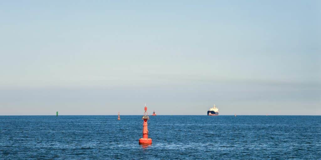
Automated vessel tracking assists stakeholders in the shipping, trade, and maritime security sectors in effectively addressing major challenges. By providing real-time visibility of each ship’s precise location worldwide, it significantly enhances safe navigation, operational efficiency, transparency, and security throughout the entire maritime industry.
What is vessel tracking and does it work?
Vessel tracking is the process of tracing and monitoring the movements of ships in real-time. A range of technologies and systems is used to locate a vessel’s exact location at any given moment, while also collecting data about its speed, course, etc. Thanks to this process, all concerned parties have remote access to the relevant information whenever necessary without solely relying on the ship’s captain.
Here are the main vessel monitoring systems used:
- Automatic Identification System (AIS): transponders installed on ships transmit and receive signals that contain vessel information. These signals are received by shore-based AIS receivers or satellites, enabling other vessels’ crew, companies, and authorities to obtain real-time information on the positions of ships.
- Satellites: receivers capture AIS data from vessels. These systems provide global coverage, allowing ships to be tracked even in remote areas where shore-based AIS infrastructure is limited.
- Radar: Vessel detection and tracking are based on radio waves. They emit a signal that bounces off a ship’s metal surface and returns to the radar receiver, providing information about the vessel’s location, distance, and direction.
- GPS (Global Positioning System): it is often integrated into vessel tracking systems. GPS receivers on board ships collect location data from GPS satellites to determine the vessel’s exact position.
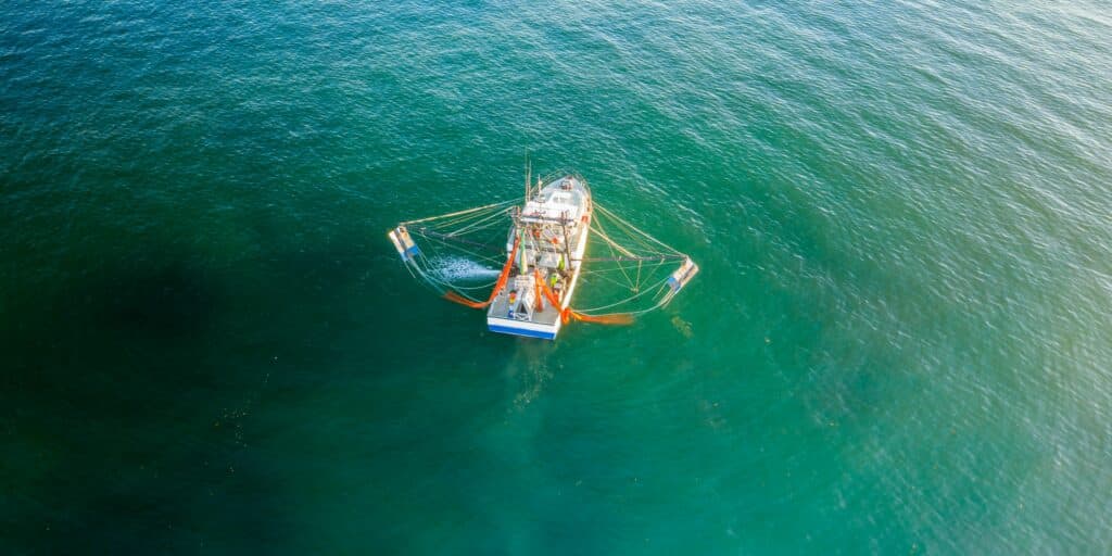
- Vessel Monitoring Systems (VMS): they are specifically designed for monitoring and managing fishing vessels, using satellite-based tracking devices, which transmit location information to monitoring centers.
Vessel tracking software combines data from these technological tools to provide real-time information about a ship’s location and movements. This information is typically displayed on digital maps or charts for easy visualization and vessel monitoring.

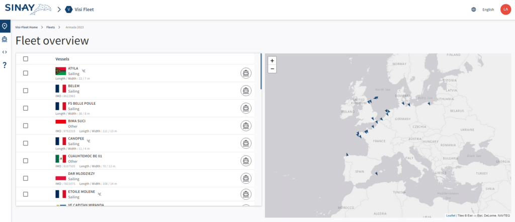
Sinay’s Visi-Fleet module stands out as one of the most sought-after tools. It offers a user-friendly interface that allows stakeholders to compile a comprehensive list of vessels. By leveraging this module, users can effortlessly track the real-time positions of each ship within the fleet through an intuitive map display. Moreover, the module provides valuable insights into recent vessel activities, enabling users to calculate the Estimated Time of Arrival (ETA) at the next port of call or the final destination port, if required.
The ETA Calculator (ETAC), powered by Artificial Intelligence, utilizes a multitude of data from AIS and satellite sources to deliver highly accurate predictions. Factors such as weather conditions, vessel traffic in the area, and potential hazards are taken into account to generate precise ETA estimates. With just the ship’s name or its unique MMSI/IMO number entered on the welcome page, users can access the ship’s most recent known position, including the date, UTC, latitude, and longitude. This streamlined approach ensures that stakeholders can easily obtain critical information about vessel movements and plan their operations accordingly.
Sinay provides dedicated APIs for all players in the ocean freight industry, facilitating swift and seamless integration into their information systems. The ETA API enables users to obtain accurate predictions of the arrival date and time for any vessel. Additionally, there is a port congestion API that provides real-time status updates for ports worldwide.
How to Track a Ship In Real-Time ?
Let us look at how a ships’ real-time tracker works, its details and features, its benefits for all players in the shipping sector but also its weaknesses…
Why is vessel tracking essential in shipping industry?
Safety and Security
Tracking vessels allows authorities and maritime organizations to monitor the location and movements of ships, enhancing safety at sea. It helps avoid collisions, and monitor unauthorized activities, such as illegal fishing activity.
In addition, by enabling efficient monitoring, control, and surveillance of all types of sailing ships, these technologies play a crucial role in emergency response and search and rescue operations. In the event of an incident, authorities can quickly identify nearby vessels and coordinate rescue efforts based on their real-time positions. This capability allows for a faster response time, improved coordination between rescue teams, and increased chances of successful outcomes.
Navigation and Routing
Thanks to monitoring systems, ship captains and crews have access to real-time information regarding the positions and routes of other vessels. They also have comprehensive visibility of weather conditions in all areas they are expected to navigate during their journey.
This vessel tracking data enables efficient navigation and assists ships in avoiding hazards like shallow waters and storms. Additionally, identifying potentially congested zones helps optimize vessels’ routing and speed, ensuring adherence to the expected time of arrival at the next ports of call.

Maritime Operations and Logistics
In order to effectively plan and manage maritime and logistics operations, all stakeholders need accurate and reliable information about vessels at sea.
- Vessel tracking software is an invaluable tool for shipping lines, enabling them to maintain a real-time view of their entire fleet, allowing accurate scheduling based on various factors such as weather conditions, port congestion, or unforeseen delays. Furthermore, it assists ocean carriers in fleet management optimization by providing comprehensive insights into fleet performance and utilization so as to make efficient use of its capabilities, choose the best routes, reduce fuel consumption, mitigate operational costs, and minimize environmental impact.
- For shippers, importers, port operators, and logistics providers, having access to up-to-date information on vessel movements and estimated arrival times are essential for resource allocation, including human resources, equipment, and space in container yards, and warehouses. This information allows them to effectively plan and organize port operations and cargo handling activities.
- Authorities harness vessel tracking data for maritime traffic management purposes. They can identify potential bottlenecks or busy shipping lanes or ports and take proactive measures to ensure smooth flow. This includes implementing traffic control measures, designating alternative routes, and adjusting vessel speeds.
Furthermore, vessel monitoring helps to manage the movement of hazardous cargo or vessels carrying dangerous goods and provides appropriate guidance to mitigate potential risks.
Overall, ship monitoring systems enhance global supply chain visibility and streamline operations by ensuring smooth coordination between all parties involved.
Compliance and Regulations
Furthermore, vessel monitoring plays a crucial role in enforcing maritime regulations and ensuring compliance with international laws and regulations. Governments and regulatory bodies, such as the International Maritime Organization (IMO), have established standards pertaining to trade, environment, shipping, fishing, and security.
The environment is also a key aspect when it comes to achieving the sea shipping sector’s ambitious goal of lowering its carbon emissions by at least 50% compared to the 2008 levels by 2050. Monitoring systems enable effective control of ship activities, thereby ensuring that the maritime industry stakeholders operate in a responsible and sustainable manner.

The role of vessel tracking for the fishing industry
Vessel monitoring technologies play a significant role in the fishing industry, ensuring responsible fishing practices, protecting marine resources, and supporting the long-term viability of fisheries. By tracking fishing vessels with VMS, authorities can:
- ensure respect for fishing quotas, restricted areas, seasonal closures, and other small-scale fisheries management measures. It helps in preventing overfishing and protecting vulnerable marine species.
- prevent illegal, unreported, and unregulated (IUU) fishing: All fishing vessels that are licensed are required to have AIS transponders or other tracking devices installed, allowing their movements to be monitored and analyzed. Any suspicious activities, such as entering prohibited areas or disabling tracking devices, can raise alarms and initiate investigations into potential instances of IUU fishing.
- verify catch documentation to verify the origin and legality of seafood products. Authorities can ensure that the reported catch aligns with the actual fishing activities, reducing the risk of seafood fraud and misreporting.
- enhance maritime domain awareness: having a comprehensive view of fishing vessel activities enables authorities to identify patterns, trends, and hotspots of fishing activity, contributing to effective marine resource management and conservation efforts.
- improve collaboration and information sharing between countries and organizations involved in fisheries management. By exchanging vessel tracking data, they can coordinate their efforts to combat IUU fishing, enforce regulations, and promote sustainable fishing practices.
- enforce compliance with fishing regulations.
Some VMS systems may incorporate AIS data as part of their monitoring capabilities, providing additional information on fishing vessels’ movements and enabling more comprehensive monitoring of fishing activities. VMS data increases the effectiveness of global fishing watch
Conclusion
Vessel tracking offers numerous benefits across different aspects of the shipping industry. By leveraging advanced tracking technologies, stakeholders can drive positive changes in the industry and ensure the long-term viability of global shipping and fishing activities.
Frequently Asked Questions About Vessels Tracking
Vessel tracking is important because it enhances safe navigation, operational efficiency, transparency, and security in the maritime industry.
It provides real-time visibility of each ship’s precise location worldwide, allowing stakeholders to monitor movements, avoid collisions, and respond quickly to emergencies.
The main vessel monitoring systems used for tracking include Automatic Identification Systems (AIS), satellites, radar, GPS, and Vessel Monitoring Systems (VMS).
These technologies collect data on a ship’s location, speed, and course, providing real-time information to stakeholders.
Vessel tracking is essential in the shipping industry as it enhances safety and security, facilitates navigation and routing, improves maritime operations and logistics, and ensures compliance with regulations.
It helps prevent accidents, optimize routes, plan operations, allocate resources efficiently, and enforce maritime regulations.
Vessel tracking plays a significant role in the fishing industry by promoting responsible fishing practices, protecting marine resources, and combating illegal fishing.
It helps enforce fishing quotas, prevent illegal fishing activities, verify catch documentation, enhance maritime domain awareness, and facilitate international collaboration for sustainable fisheries management.


